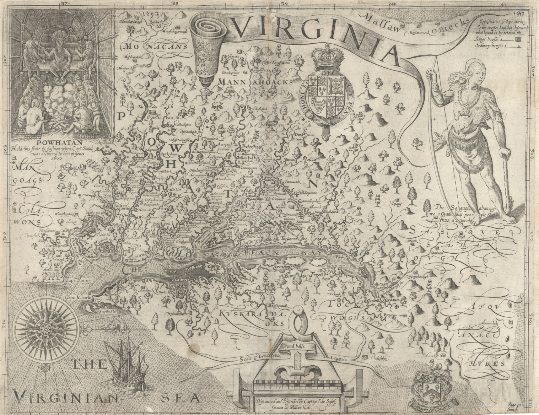
John Smith’s Map of Virginia, 1612
Created by Captain John Smith in the early 1600s, this map was the first detailed map of the Chesapeake Bay region. Alongside rivers, coastlines, and other geographic features, Smith also identified dozens of American Indian towns. Published in 1612, the map depicts not only present-day Virginia, but also parts of what are now Maryland, Delaware, Pennsylvania, and Washington, D.C. For nearly seventy years, Europeans relied on this map as they explored the region, established settlements, and developed trade networks.